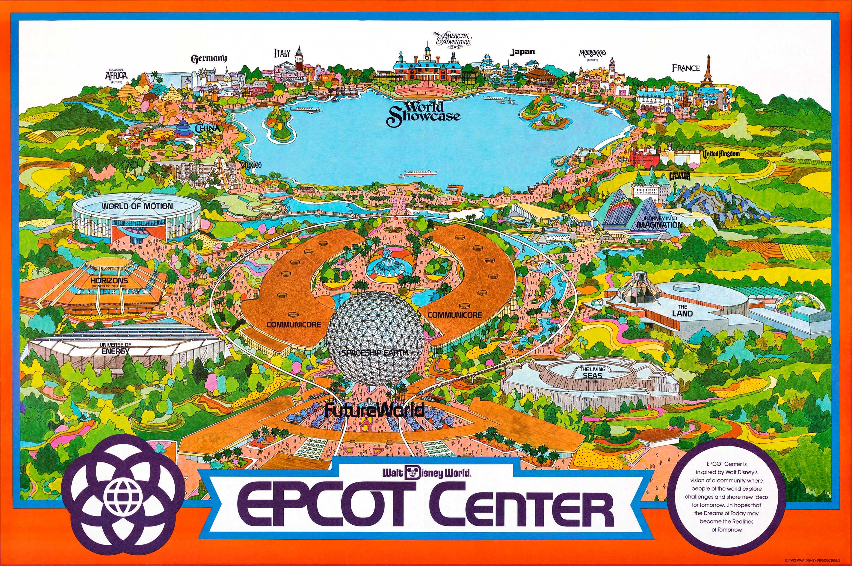
Archiving Epcot's artwork is almost neverending and even more widely known pieces aren't given the proper care needed for preservation. Case in Point, EPCOT Center's original "Fun Map" which you could also say was its only Fun Map.
As with all "Fun Maps", this one is not a proportionally accurate depiction of the park but does provide a comprehensive look at the park's offerings and some that were never realized. In particular, you'll notice Equatorial Africa between China and Germany, as well as a completed Horizons and The Living Seas that would even begin construction until two years after this map's creation. And finally, all the backstage areas have been replaced by idyllic pastoral landscapes with terrain not found in Florida.
As part of my preservation and enhancement efforts, I took a high-resolution scan (seen above), digitally cleaned the image, and repaired the fold lines. Afterward, I ran it through a few AI upscalers and selected the best one for increased clarity. Below are the surprising results: